

1. Victoires, conquêtes, désastres, revers et guerres civiles des Français, de 1792 à 1815, par une Société de militaires et de gens de lettres.
Tome vingt-unième. Paris. C.L.F. Panckoucke, Éditeur.
Rue des Poitevins, № 14. 1820.
 .
.

 – Ambroise Tardieu (1788-1841) – Author, Resources from the BnF
– Ambroise Tardieu (graveur), Wikipédia
– Тардьё, французские граверы, Энциклопедический словарь Брокгауза и Ефрона, том 32а, 1901;
– ЭСБЕ_Тардье, французские граверы, Викитека; п.4.
.
Источник:
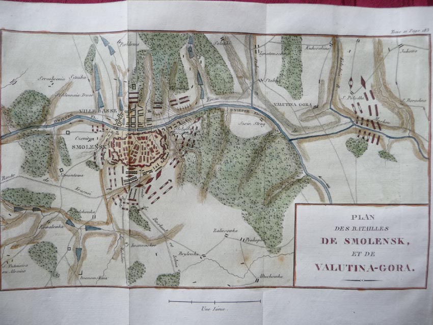
![]() Gallica > Victoires, conquêtes, désastres, revers et guerres civiles des Français, de 1792 à 1815, стр.183.
Gallica > Victoires, conquêtes, désastres, revers et guerres civiles des Français, de 1792 à 1815, стр.183.
Дополнено 19.07.2017 (1)
2. Battles of Smolensk & Valutino 1812. French Invasion of Russia, 1820 old map.
Artist-cartographer-engraver unsigned.
 «TITLE/CONTENT OF MAP: ‘Plan des Batailles de Smolensk, et de Valutin-Gora’ …
DATE PRINTED: 1820
IMAGE SIZE: Approx 17.0 x 25.5cm, 6.5 x 10 inches (Medium); Please note that this is a folding map.
TYPE: Antique copperplate map …
AUTHENTICITY: his is an authentic historic map, published at the date stated above. It is not a modern copy. …
ARTIST/CARTOGRAPHER/ENGRAVER: Unsigned
PROVENANCE: “Victoires, conquêtes, désastres, revers et guerres civiles, des français” Published by C.L.F. Panckoucke, Paris. …».
Источник: Antiquemapsandprints.com > Battles of Smolensk & Valutino 1812
Дополнено 28.07.2017 (2)
3. Тот же план в цвете:
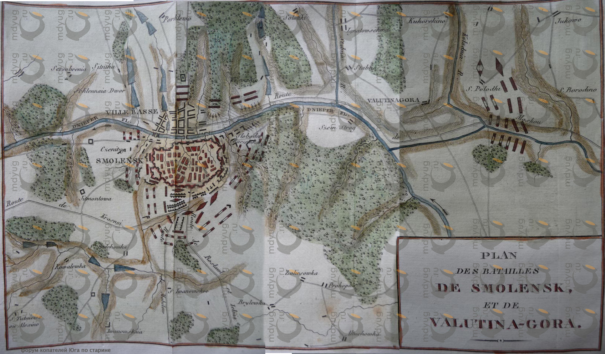
….Источники:
Smolbattle, 8457-1fc020070985b7827be6033bb4aa1bba.jpg, 850×638 px, 135,2 KB
Радикал-Фото, 4076a05bf39e.jpg, 1934×1132 px, 1,1 MB
См. также:
Перечень карт (планов, схем) Смоленского сражения 4-7/16-19 августа 1812 г.
(Продолжение следует)
Поделиться ссылкой:
Дополнено ссылкой на Antiquemapsandprints.com
Дополнено ссылками на Smolbattle и Радикал-Фото.